Hidden Segovia
Every city has places you find through the people who know it best. Hidden Segovia brings together quiet paths, unexpected corners and overlooked places worth making time for. Whether you’ve just moved here, are finding your feet in a new country or have called Segovia home for years, this is an invitation to explore a little further and get to know the city beyond its familiar sights.
Opens on Google Maps when you choose. Browse the places and local stories below.
The directory
14 places
No places found. Try another name or clear your search.

01 / Riverside walk
Alameda del Parral
Leave the hilltop streets behind for a walk beside the Eresma. The Alameda connects the city with a quieter landscape of trees, water and the monastery beyond.
Before you go
Make this a short walk in its own right, or continue towards El Parral. Follow any temporary riverside closure signs.
Visitor information ↗
02 / Heritage & a slow walk
The path to El Parral
Follow the riverside towards the Monastery of Santa María del Parral. The approach makes a lovely destination of its own, with the old city seen from outside its walls.
Before you go
A walk to the monastery and a visit inside are different plans. Check the monastery’s current visiting arrangements before setting out.
Visitor information ↗
03 / Panoramic route
Ruta del Asombro
A longer route linking El Parral, Vera Cruz, San Marcos and the Clamores valley. This is Segovia from its slopes and riverbanks, with the skyline accompanying the walk.
Before you go
The tourism office lists the full route as 5.5 km, around 1 hour 45 minutes, with medium difficulty and low accessibility. Allow more time for stops.
Visitor information ↗
04 / Green escape
Valle del Clamores
A green valley below the old city offers a different way to read Segovia’s landscape. Nearby paths lead towards the Pinarillo and views back towards the Jewish quarter.
Before you go
Choose your return climb before you go: some connections to the old town involve steps. Wear shoes suited to paths and uneven ground.
Visitor information ↗
05 / Water & industrial heritage
Senda de los Molinos
Between San Lorenzo and San Marcos, the river reveals another side of the city: landscape, geology and the legacy of its mills. A good starting point for exploring the Eresma valley.
Before you go
You can explore a section rather than committing to the whole walk. Plan where you will leave the river and return to town.
Visitor information ↗
06 / Local history · access to confirm
Cuevas del Champiñón
Above El Parral, caves tell an unexpected story of quarrying and mushroom cultivation. A documented heritage visit in 2013 explored this little-known part of Segovia’s working landscape.
Before you go
This is not a confirmed walk-in attraction. Ask Turismo de Segovia about authorised visits and current access; do not enter caves or working premises without permission.
Visitor information ↗
07 / Views & quiet corners
Mirador de la Pradera de San Marcos
Down at the meadow, the Alcázar rises above the trees and rock face. Stop here for the view, then make the riverside paths part of a slower walk around San Marcos.
Before you go
This is a viewpoint below the Alcázar, not its visitor entrance. Combine it with a walk along the Eresma.
Visitor information ↗
08 / Local heritage
Iglesia de la Vera Cruz
Beyond the old town, this striking church stands on the road to Zamarramala. Founded in 1208, it offers a quieter encounter with medieval Segovia, away from the busiest streets.
Before you go
Check current opening hours before planning an interior visit. Allow time for the walk from San Marcos.
Visitor information ↗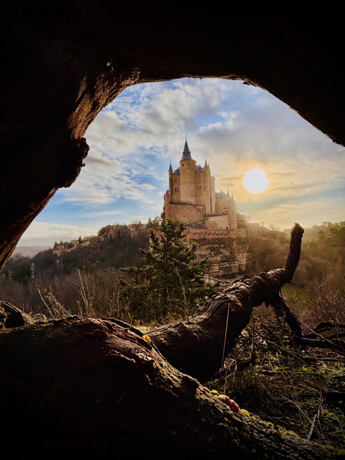
09 / Views & quiet corners
Mirador del Último Pino
Take the paths towards the Pinarillo for another perspective on the city. The Último Pino viewpoint brings the Alcázar and Cathedral into a wider landscape of slopes, trees and open sky.
Before you go
Follow the signed Camino Natural del Eresma approach. Expect uneven ground and uphill sections; choose footwear for a walk rather than a city stroll.
Visitor information ↗
10 / Views & quiet corners
Jardín de los Poetas
Near the Puerta de Santiago, this garden opens out towards the Eresma valley. Its setting invites a pause between the streets of the old town and the monuments beyond the walls.
Before you go
The city has announced renovation works here. Check access before making a special trip; the photograph shows the garden before those works.
Visitor information ↗
11 / Local heritage
Puerta de San Andrés
At the edge of the Jewish quarter, this gateway makes the city walls feel close and tangible. Pause beneath its towers, then follow the surrounding streets for a different view of the old town.
Before you go
The gateway and a visit to the wall are different experiences. Check current access and tickets before planning to go up.
Visitor information ↗
12 / Local heritage
Real Casa de Moneda
Beside the Eresma, Segovia’s old mint tells a story of money, machinery and the river that powered industry. Make it a stop on a riverside walk, or linger for a museum visit.
Before you go
Check tickets and opening times before visiting the museum. Guided visits and access to the Jardín del Rey may have specific arrangements.
Visitor information ↗
13 / Local heritage
Monasterio de San Antonio el Real
Follow the Aqueduct away from its monumental arches towards another side of Segovia. San Antonio el Real gives this walk a heritage destination of its own, beyond the usual old-town circuit.
Before you go
Plan an interior visit around the current guided-visit programme. Check availability before setting out.
Visitor information ↗
14 / Local heritage
Plaza de la Merced
A garden square for slowing down in the historic centre. Created on the site of a former convent, this is a place to sit for a moment and let an unhurried walk through Segovia unfold.
Before you go
Include it as a restful stop while exploring the old town. The square also has a children’s play area.
Visitor information ↗Keep wandering
Other places to explore along the way: El Pinarillo, the Jewish cemetery, the Senda de los Suspiros, Puente de los Huertos and the Fuencisla gardens. Our collection will grow with more local stories and practical guides.
Explore the city’s official walking information ↗